Archive
August 2014 radiative cooling East Anglia, Northern Ireland, South Midlands
August 2014 there was a meteorological gift of both exceptional conditions and good data. What can be learnt?
Three Met Office sites showed a signature of exponential cooling. This requires clear sky and a calm. Given somewhat limited parameter hourly data the following shows the commonality. The computed terminal conditions are shown later in this article.
Benson and Santon Downham data has been normalised to Katesbridge[3], which has the least noisy data or the three.
Achieving a close overlay requires taking earth rotation into account, dusk and dawn move relatively both by geographic location and the peculiar movement throughout the year as night length changes, these do not move together [1]. Fractional delay (less that the sample period) was used to equalize diurnal time. (see the two blog articles here)
Dusk appears to be the important factor, a surprising finding, I assume cooling is time from dusk, dawn terminates cooling.
General information, under essentially calm conditions wind drops for a period during the night then reappears just after dawn. (not shown here)
Temperature normalisation defined is for the cold period, not as accurate for Benson where the better site exposure (more open) led to more wind at times.
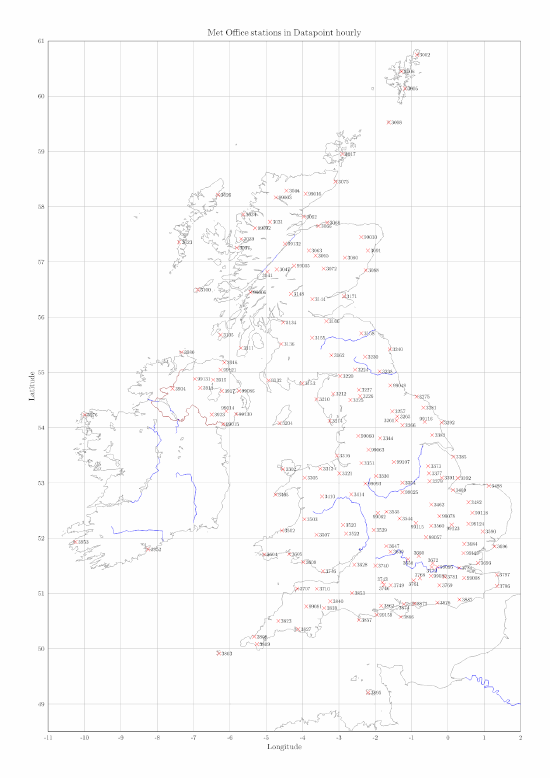
UK outline map and Met Office Datapoint
I’ve been busy pottering on code as a mindless intermission during house repairs, can only do so much at a time. Argue with a piece of wood or with a computer screen? 🙂
This is a bitmap copy of a map of the UK with markers showing the location of Met Office weather sites with hourly data published via their Datapoint service. Data is under OGL (Open Government Licence) which allows usage. Unfinished work, references are not yet included.
The real file is part of a large PDF (vector format) containing plots for all those stations during a 24 hour period.
Example PDF https://daedalearth.files.wordpress.com/2014/08/uk-2014-08-24-0045.pdf (1.2MB, work in progress, more to be done)
Human warming of Great Lakes
Image NOAA, click for full size.
I came across the above graphic. On pondering I went huh?
The most eastern (right hand) is Lake Ontario. Is that a mistake, the only one largely ice free 2014, largely clear 1994.
Well…
Hugin and correction of photographic distortion
Superconducting conductors arriving at Fermilab, credits at end.
None of you will know I have history in photography, award winning, newspaper front page, glossy magazine front page, etc., none earth shattering but it was a personal challenge in the film era. Put another way I have an interest from both the art and technical perspective.
I intended producing a minor blog post on Fermilab and the magnet, ideally posts need a good headline photograph, what with copyright and poor technical standards this is often tricky. My own blog, this one, tends to get poor art.
Lomonosov University and the study of high atmosphere electrical events, satellite planned
A new university satellite is scheduled launch 2015[1]. A web site for the project is available in English
Mikhail Lomonosov (1711 – 1765) helped establish what is now known as Moscow University, decree signed 1755, 250 years ago.
According to Lomonosov’s plan, there were originally three faculties. First all the students acquired a comprehensive knowledge in the field of science and humanities at the Faculty of Philosophy; then they could specialize and continue at the Faculty of Philosophy or join either the Law Faculty or The Faculty of Medicine. Lectures were delivered either in Latin, the language of educated people at the time, or in Russian. [2]
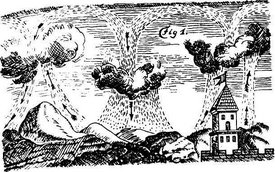
 Aurora drawing |
Illustrations from a book published 1753. Text, perhaps embellished a little as these things are, “Mikhail Lomonosov – the Pioneer of Russian Science” nevertheless looks a good fellow.
The satellite is named Lononosov.


